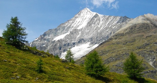
This is lesser-known as a very diverse walk with exceptionally delightful views. This hike takes you to a remarkable panoramic location high above Tasch. The views take in the pristine Schali basin below the Schalihorn and Weisshorn and also, on the other side of the valley, you can see the Mischabel range with Dom and Taschhorn and the Alphubel western flank above the Taschalp. The scenery is absolutely breathtaking. The route ascends along the very steep flank with some craggy cliff faces and passes through marvelous strands of larch.
The starting point is from Tasch at 1438 meters and the grade of hike is a bit challenging with a hike along steep trail with a few short stretches marked throughout. The height difference is about 810 meters and the walk is approximately 4 hours.
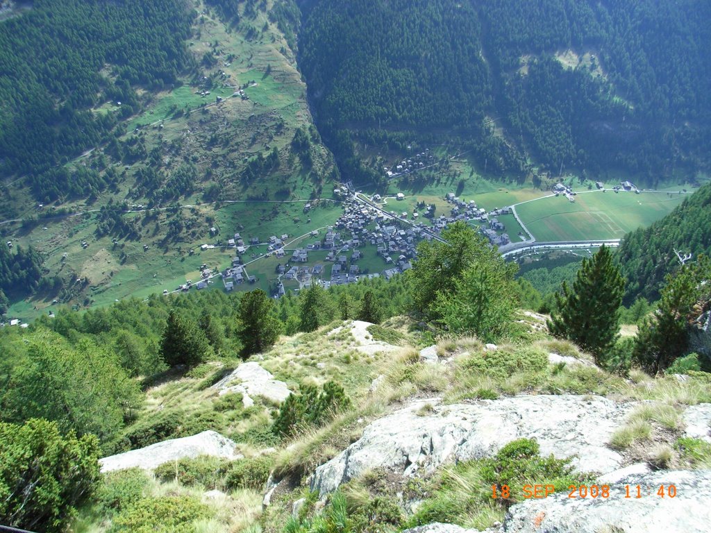
Starting behind the railway station at Tasch, you cross over the Vispa bridge then bear right for a few meters to reach the fork for the path, where there are trail signs posted directly next to the campground. The trail winds through open terrain for a short time with zigzags and then continues ascending through a steep larch wood. Further up, the trail winds cleverly along cliff faces with at a secured ladder at one place. The wood thins out higher up and Swiss pine begins to appear until just above the treelines, where delightful views open up and an almost level stretch crosses over to the scenic over look of Arigscheis.
An excursion along a path that only slightly ascends for about 3/4 kilometers to the edge of a height is worth the extra effort since it opens up to a splendid view of the Schali Glacier basin and the rugged and ragged glacier itself. After enjoying the view, you should return to Arigscheis since the direct descent of the route which is located below can be very difficult to walk due to the rocky terrains.
To get back from Arigscheis, there is a trail that descends diagonally through the flank of the valley south of the Schalibach to Schalenabi, an open pasture terrain with strands of Swiss pine and larch. Just before you reach the Schalikin Gorge, the trail turns right and descends down the valley through woodland. Finally with bends, descend to the valley floor of the Vispa. The last stretch leads along a road that runs parallel to the Vispa and returns to Tasch after about 1.5 kilometers of walking.
