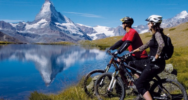
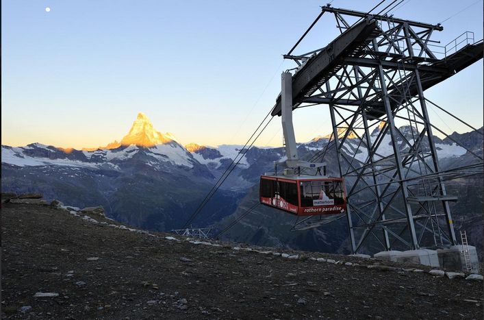
Rothorn to Zermatt is a downhill ride from Rothorn to Zermatt entailing a vertical drop of 1678 meters. The trail reveals the finest views of Zermatt for mountain bikers with the Matterhorn, lush alpine pastures, mountain forests and terrific trails. It is a dream ride that riders will want to relive time and again. If you want more challenge you can trail in reverse from Zermatt up the Rothorn. But if you’re not up for the challenge you can just take the Rothorn cable car which will take you up to 3103 meters. This trail starts from Rothorn and ends at Zermatt with the distance of 12.40 kilometers and taking approximately 2 hours. The difficulty is medium with the highest point of 3091 meters and ascent for 196 meters with descent of 1676 meters. It is a nice relaxing ride with various restaurants, mammots and chamois nearby for you to enjoy.
Tasch to Taschalp is a ride that takes up to Taschalp and deep into the valley begins with an ascent of the slopes above Tasch, mostly following small mountain roads. The climb is technically straightforward and boosts fitness. The final section of the route after Taschalp leads deep into the secluded mountain valley at the foot of the Rimpfischhorn. The soundtrack comes from the cascading Mellichbach river and all around is pristine nature. Back at Taschalp, the cheese dairy is worth visiting. The difficulty of this trail is medium starting at Tasch and ending at Taschalp. The distance is 9.08 kilometers taking approximately 2 hours. The highest point is 2281 meters with an ascent of 975 meters and descent of 134 meters. On this trail, you can stop at Taschalp for delicious cheese and Ziger soft cheese and during the ascent in a larch forest, you can view the magnificent Matterhorn.
Tasch to Randa is an easy trail and is perfect for the whole family. It leads along the valley floor through forests, along meadows and through typical Valais mountain villages. This leisurely ride leads along the Vispa river and on the other side of the valley, past meadows and scattered mountain forests. One of the highlights of this bike trail is the view of the Randa landslide. A vast cone of fallen rock, with boulders as big as houses, bears witness to the cataclysm of 1991. A large chunk of the mountain descended in three slides, burying the railway, road and the Vispa river. Miraculously no one was hurt. The bike trail leads past the spectacular sight. The starting point of this trail is at Tasch and ends at Tasch with the distance of 15.01 kilometers taking approximately 2 hours. This fairly easy trail has the highest point of 1586 meters and ascent of 508 meters and descent of 508 meters. On this trail there are many shady spots and barbecue sites ideal for resting and picnicking with wealth of alpine flora and alternating sunny and shady stretches.
