The Strahlhorn at 4190 meters, is the most southerly 4000 meter peak of the Mischabel Group, that is part of the huge Pennine Alps between Simplon pass and Grand St. Bernard pass. Mischabel Group are the mountains of the ridge between the Swiss valleys of Saas and Zermatt. South of Strahlhorn is the Schwarzberg-Weisstor mountain pass and very close to the Italian border at the ridge above the Macugnaga valley.
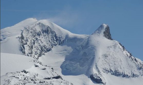
The Strahlhorn has always provided a rich yield of needle quartz, known as “Schtrale” in the Zermatt dialect hence the mountain’s name. Today, the mountain is almost completely covered in glaciers. All around the Strahlhorn you can find a complex system of glaciers and ridge. Together with the near Rimpfischhorn it is the center of this system. The two mountains have a distance of 1.75 kilometer and are separated by the Adler Pass. From these two points a great system of ridges start. To the south to the Schwarzberg-Weisstour pass, it is very close to the Italian border that runs over the Schwarzberghorn/Corno Nero, where the terrain falls steep to the Macugnaga valley. To the north, from the Rimpfischhorn, further along the great chain of the Mischabel mountains, to the north-east, via the minor summit of the Fluchthorn down to the Mattmarksee in the high Saas valley, to the west from the Strahlhorn there is only a short ridge that carries the Adlerhorn and to the west from the Rimpfischhorn begins a long ridge that carries the Oberrothorn, a popular hiking mountain above Zermatt.
Even in warm weathers and season, the view is absolutely beautiful. At each side of the two mountains, big glaciers spread wide out. In south-west direction there is the big Findeln glacier that runs towards Zermatt, with it’s small branch of the Adler glacier that leads steep to the Adler Pass. From the north-west of the Rimfischhorn, is the very crevassed Mellich Glacier which hikers have to cross if coming from the Tasch hut, from the north is the big Allalin Glacier that carries the normal route and in the east is the Schwarzberg glacier that also runs to the Saas valley.
The normal route reaches the summit from the north by a very long walk from the Britannia hut along the Allalin Glacier via the Adler pass. This is easy, of course there is danger of falling into some huge crevasses. It may be a bit boring for hikers who wants more challenge, therefore, more popular climb to Strahlhorn is in spring with skis. The last day of the famous Haute Route for ski mountaineers from Chamonix to Saas Fee crosses the Adler pass. The Strahlhorn is usually climbed form Britannia hut, where the easiest routes starts. The elevation could be gained by ridges, usually long and quite uniform, or walls, more steep and more difficult, usually with exits on the summit ridge between the main summit and the roe summit. Some routes start in Italian territory at the Bivouac Citta di Luino or at the Refuge E. Sella or the Refuge G. Oberto, both on the ridge of the Jazzi in the Monte Rosa Group.
